History
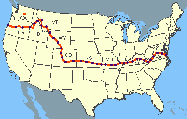
The TransAmerica Bicycle Trail began in 1973 as nothing more than an ambitious idea for a way to celebrate the nation’s upcoming 200th birthday. By June of 1976, the Trail was ready; the maps and guidebooks were published thanks to an enormous effort. Now cyclists were needed to ride it across the country. Given the name “Bikecentennial,” organizers publicized the event and thanks to strong word-of-mouth and its fortunate, prodigious publicity, 4,000 cyclists showed up for the ride.
Most of the riders were in their 20s and had no experience with long-distance cycling. They traveled in groups of 10 to 12 with leaders trained by Bikecentennial. There were few helmets to be seen and the bikes were often discount-store quality.
But the equipment scarcely mattered. This group of people set out to have the experience of a lifetime and for the most part they did,
learning about America and about themselves in a profound way.
Indeed, many cyclists who rode across the country in 1976, and those who ride the Trail today, say essentially the same thing about the experience, “I learned more about this country in 90 days than most people learn in a lifetime.”
The Eastern Kentucky Leg
The route crosses the Mississippi River at Chester, Illinois, and heads into Carbondale, another fun college town. A ferry takes you across the Ohio River into Kentucky, where you'll enjoy the evening fireflies at your campsites. Kentucky offers rolling white-fenced farms and woodlands until reaching Berea, the gateway to the Appalachian Mountains. A loop south of the route will take you to see Mammoth Cave National Park, the longest cave system in the world. Past Berea, you'll spend some time ascending and descending the mountains of the Appalachians, and riding
part of the Blue Ridge Parkway in Virginia.
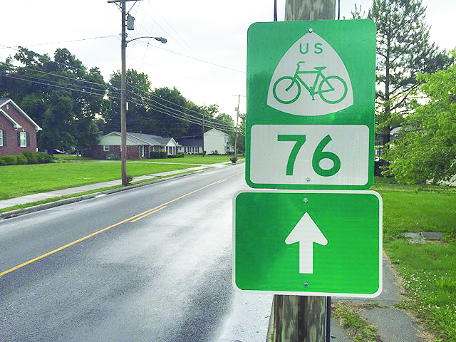
The Kentucky section of this national trail is more than 500 miles long. In spring 2013, AASHTO approved the submitted realignments and updates for USBR 76 (TransAmerica Bicycle Trail), which runs east to west through Kentucky from rural Crittenden County at the Ohio River to the mountainous area of Pike County. The Kentucky Transportation Cabinet (KYTC) Bicycle program team developed a Bicycle Comfort Index Rating
System/ BCI (formally called the Bicycle Level of Service (BLOS)) which was very helpful in determining the safest and most suitable routes to bike within the USBR 76 corridor. KYTC has now updatied the USBR 76 signage for the entire route across the state. KYTC continues to work with neighboring states interested in the USBRS and other
cross-state bicycle touring routes.
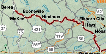
The TransAmerica Bicycle Route travels eastward out of Owsley County along Highway 28 across Breathitt County then turning south towards Buckhorn through Perry County following Highways 28, 451, and 80, then east on Highway 80/550 into Knott County. The route is clearly marked on all state maps and takes one through Booneville, past Morris Fork Crafts, then through Buckhorn and Chavies, past the Artisan Center in Hindman and Alice Lloyd College, taking the rider eventually through Elkhorn City and into Virginia.
The Perry County Leg
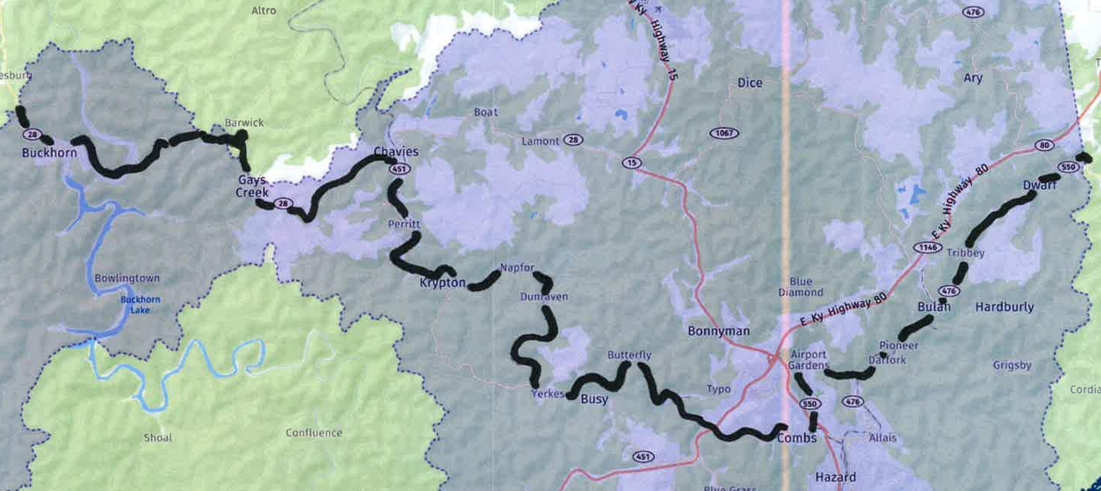
The TransAmerica Trail travels
approximately 40 miles through the northern portion of Perry County,
starting just northwest of Buckhorn near Morris Fork. The route
travels southeasterly along KY 28 to the junction of KY 28 and KY 451
just south of Chavies. The route then proceeds southeasterly through
Krypton, Yerkes, and Busy intersecting with old KY 80 near Exit 56 of
the Hal Rogers Parkway. The route then proceeds northeasterly
through Combs and Airport Gardens to the junction of KY 80/550/476.
The route then continues northeasterly through Darfork and Bulan to
the intersection at Dwarf. The route leaves KY 476 and travels along
KY 80/550 to the Knott County line.
Perry County Stopover
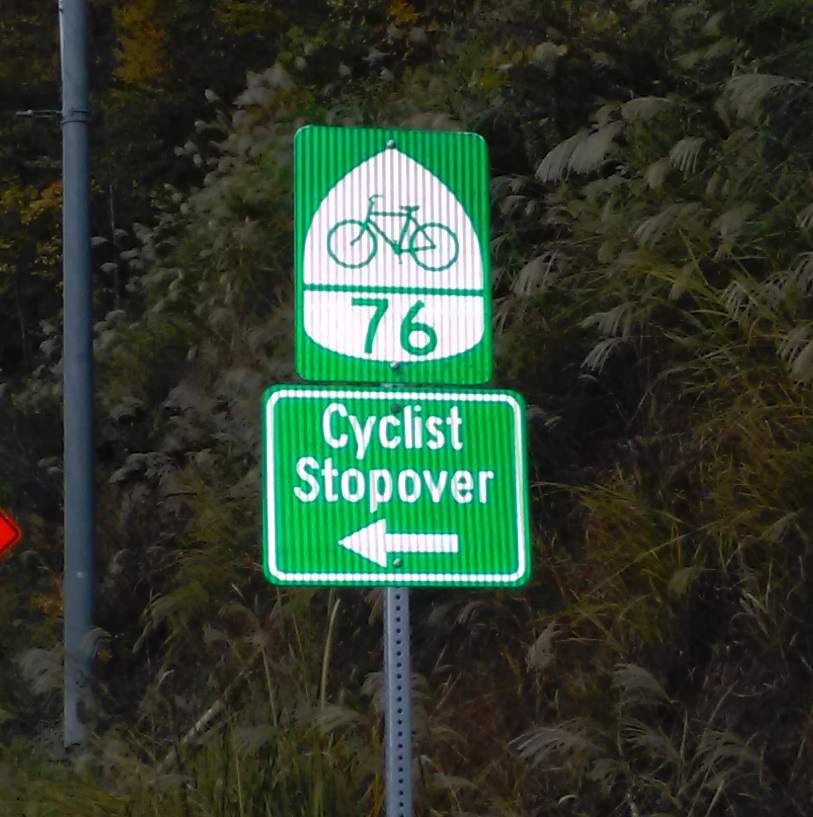 County Judge Executive Scott Alexander wants to welcome cyclists to Perry County, Kentucky, and has announced that a stopover for cyclists travelling the USBR 76 Bike Route has been established. The stopover will be located in the Perry County Park and will offer free admission to the county pool (in season),
free shower,
free primitive campsite area (no fires allowed but in-place grill is available) or outdoor shelter, and
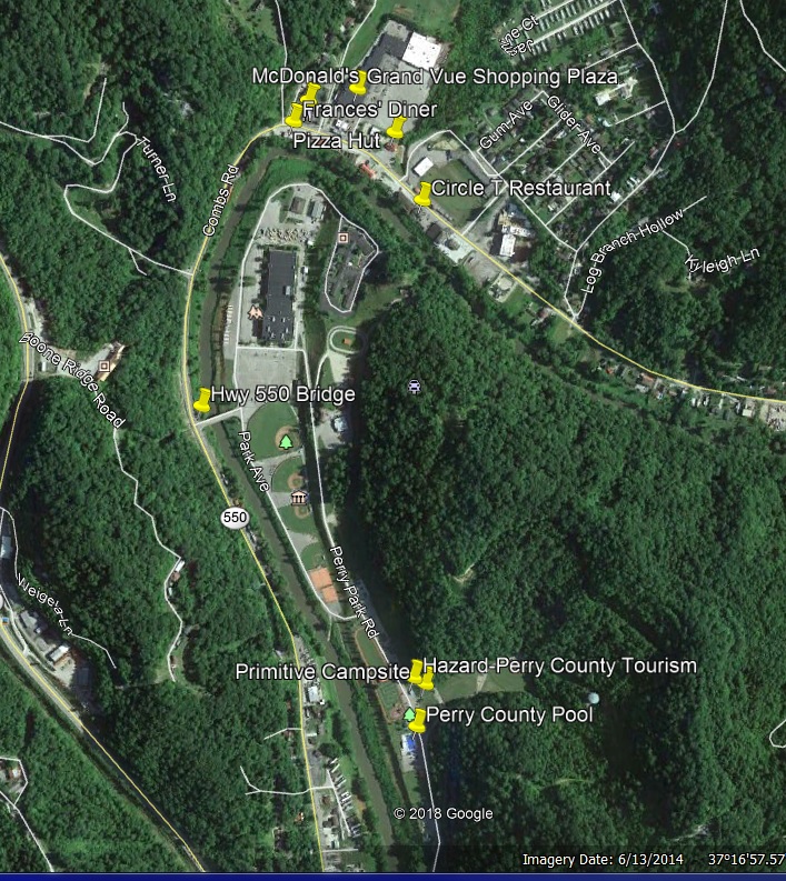
free cell phone charging. There are two restaurants serving home-cooked meals, three fast food restaurants, and a small shopping mall within one-quarter mile of the Perry County Park. The Perry County Park is accessed off KY 550 across the bridge toward Perry County Central High School. Appropriate signage has been posted for directions. The approximate coordinates for the bridge are 37o16'56” N and 83o12'44” W (from Google Earth). Please call ahead to make arrangements at 606-439-1816.
County Judge Executive Scott Alexander wants to welcome cyclists to Perry County, Kentucky, and has announced that a stopover for cyclists travelling the USBR 76 Bike Route has been established. The stopover will be located in the Perry County Park and will offer free admission to the county pool (in season),
free shower,
free primitive campsite area (no fires allowed but in-place grill is available) or outdoor shelter, and
free cell phone charging. There are two restaurants serving home-cooked meals, three fast food restaurants, and a small shopping mall within one-quarter mile of the Perry County Park. The Perry County Park is accessed off KY 550 across the bridge toward Perry County Central High School. Appropriate signage has been posted for directions. The approximate coordinates for the bridge are 37o16'56” N and 83o12'44” W (from Google Earth). Please call ahead to make arrangements at 606-439-1816.
Links
Adventure Cycling Association
Kentucky Transportation Cabinet